
1969 Map of Mountain View SW
USGS Topo · Published 1971About this map
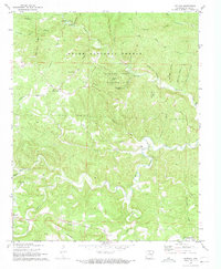
Turkey Creek and Tomahawk Creek carve through the varied topography of Stone County, defining a landscape of narrow hollows and high ridges. The area reflects a late-1960s rural character where small settlements like West Richwoods and Sunny Land are connected by a network of winding roads and trails. Evidence of local heritage is clear in the distribution of community landmarks, including the Mennonite Ch and Cem Elizabeth Ch. The terrain transitions from the heights of Blue Mountain and Indian Knob down into numerous family-named valleys such as Murphy Ridge and McGee Hollow. Agricultural activity is marked by fence lines visible from aerial photography, while industrial traces appear at the Quarries and a Mine near Coal Hollow. This documentation provides a record of the Ozark foothills before more modern development, preserving the location of established cemeteries like Fredonia Cem and Finch Cem.
Find a feature on this map
78 named features on this map. Tap any name to fly to it.
Don’t see what you’re looking for? This feature index may not catch every label — zoom into the map to look around manually.
Map Details
Editions of this 1969 Mountain View SW Map
This is the sole edition of this map. No revisions or reprints were ever made.
Other maps of this area

1892 · Mountain View
USGS Topo · 1:125,000

1894 · Mountain View
USGS Topo · 1:125,000

1956 · Russellville
USGS Topo · 1:250,000

1964 · Russellville
USGS Topo · 1:250,000
1964 · Sylamore
USGS Topo · 1:24,000
1969 · Fox
USGS Topo · 1:24,000
1969 · Mountain View
USGS Topo · 1:24,000
1972 · Onia
USGS Topo · 1:24,000
1972 · Fiftysix
USGS Topo · 1:24,000
1973 · Shirley
USGS Topo · 1:24,000