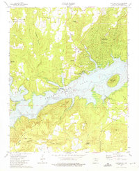
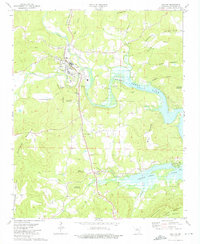
1973 Map of Fairfield Bay
USGS Topo · Published 1973About this map
Greers Ferry Lake dominates this 1970s landscape, illustrating the dramatic change in the White River basin following the mid-century creation of the reservoir. The map reveals the newer development of Fairfield Bay on the northern shore, complete with its United Methodist Ch and Sewage Disposal infrastructure. This suburban growth contrasts sharply with the older rural character of Eglantine, where the Eglantine Cem and Bradford Cem remain as markers of the area's earlier settlement.
Find a feature on this map
51 named features on this map. Tap any name to fly to it.
Don’t see what you’re looking for? This feature index may not catch every label — zoom into the map to look around manually.
Map Details
Editions of this 1973 Fairfield Bay Map
3 editions found
Other maps of this area

1892 · Mountain View
USGS Topo · 1:125,000

1894 · Mountain View
USGS Topo · 1:125,000

1956 · Russellville
USGS Topo · 1:250,000

1961 · Bee Branch
USGS Topo · 1:62,500

1961 · Bee Branch
USGS Topo · 1:24,000

1961 · Morganton
USGS Topo · 1:24,000

1963 · Quitman
USGS Topo · 1:24,000

1964 · Russellville
USGS Topo · 1:250,000
1973 · Greers Ferry
USGS Topo · 1:24,000
1973 · Clinton
USGS Topo · 1:24,000