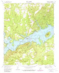
1973 Map of Fairfield Bay
USGS Topo · Published 1982About this map
Greers Ferry Lake dominates the central landscape of this survey, with underwater contours reflecting the topography before the valley was inundated. The shoreline is marked by prominent points and coves, including Peter Rock Point and Harpers Cove, while Boat Ridge Island remains visible above the water line. On the northern shores, the growing community of Fairfield Bay is shown with its early development, including a Golf Course and the United Methodist Ch.
Find a feature on this map
42 named features on this map. Tap any name to fly to it.
Don’t see what you’re looking for? This feature index may not catch every label — zoom into the map to look around manually.
Map Details
Editions of this 1973 Fairfield Bay Map
3 editions found
Other maps of this area

1892 · Mountain View
USGS Topo · 1:125,000

1894 · Mountain View
USGS Topo · 1:125,000

1956 · Russellville
USGS Topo · 1:250,000

1961 · Bee Branch
USGS Topo · 1:62,500

1961 · Bee Branch
USGS Topo · 1:24,000

1961 · Morganton
USGS Topo · 1:24,000

1963 · Quitman
USGS Topo · 1:24,000

1964 · Russellville
USGS Topo · 1:250,000
1973 · Fairfield Bay
USGS Topo · 1:24,000
1973 · Greers Ferry
USGS Topo · 1:24,000