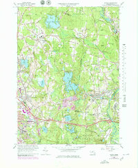
1965 Map of Shirley
USGS Topo · Published 1979About this map
Leominster and the surrounding Worcester County highlands define this mid-1960s landscape, characterized by a series of prominent glacial hills and a dense network of brooks and ponds. The eastern portion of the map is dominated by the Fort Devens Military Reservation, bounded by the Nashua River and featuring specialized infrastructure like the Treasury Hill area. Heavy transport corridors such as the Boston and Maine Railroad and Mass 2 connect the industrialized centers of Shirley and North Leominster, while smaller settlements like Goodrichville and Shirley Center maintain a more rural character.
Find a feature on this map
80 named features on this map. Tap any name to fly to it.
Don’t see what you’re looking for? This feature index may not catch every label — zoom into the map to look around manually.
Map Details
Editions of this 1965 Shirley Map
Other maps of this area

1885 · Worcester
USGS Topo · 1:62,500

1886 · Worcester
USGS Topo · 1:62,500

1887 · Marlboro
USGS Topo · 1:62,500

1887 · Fitchburg
USGS Topo · 1:62,500

1889 · Marlboro
USGS Topo · 1:62,500

1889 · Fitchburg
USGS Topo · 1:62,500

1892 · Worcester
USGS Topo · 1:62,500

1893 · Fitchburg
USGS Topo · 1:62,500

1893 · Groton
USGS Topo · 1:62,500

1896 · Marlboro
USGS Topo · 1:62,500