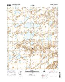
2014 Map of Shishmaref B-1 SE
USGS Topo · Published 2014About this map
Bering Land Bridge National Preserve encompasses the central landscape of this coastal Alaskan region, preserving a wilderness of thermokarst lakes and tundra. The terrain is defined by a dense network of small ponds and wetlands, characteristic of the Seward Peninsula’s permafrost-rich environment. In the southeastern portion of the map, the Cowpack River meanders through the lowlands, demonstrating the complex drainage patterns of this subarctic coastal plain. This 2014 representation emphasizes the topographical isolation of the area, where the lack of developed infrastructure underscores its status as a protected natural corridor. The map provides a precise account of the hydrography within t11n r31w, t11n r30w, t10n r31w, and t10n r30w, capturing the intricate relationship between the river system and the surrounding lacustrine features.
Find a feature on this map
6 named features on this map. Tap any name to fly to it.
Don’t see what you’re looking for? This feature index may not catch every label — zoom into the map to look around manually.
Map Details
Editions of this 2014 Shishmaref B-1 SE Map
This is the sole edition of this map. No revisions or reprints were ever made.
Other maps of this area

1950 · Shishmaref
USGS Topo · 1:250,000

1950 · Shishmaref A-1
USGS Topo · 1:63,360

1950 · Kotzebue A-6
USGS Topo · 1:63,360

1950 · Shishmaref B-1
USGS Topo · 1:63,360

1950 · Kotzebue B-6
USGS Topo · 1:63,360

1951 · Shishmaref
USGS Topo · 1:250,000

1951 · Kotzebue
USGS Topo · 1:250,000

1958 · Kotzebue
USGS Topo · 1:250,000

1964 · Kotzebue
USGS Topo · 1:250,000
2014 · Shishmaref B-1 NW
USGS Topo · 1:25,000