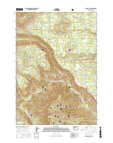
2017 Map of Shitike Butte
USGS Topo · Published 2017About this map
Shitike Butte and the volcanic peaks of Twin Buttes dominate this high-desert landscape in Jefferson County. The terrain is defined by the deep incisions of the Whitewater River and the Metolius River as they flow toward the east, separated by the elevated plateau of the Metolius Bench. This 2017 survey illustrates a complex network of forest and tribal roads, including Bia RD 41 and NW Tenino Rd, which provide access to the timberlands and grazing areas of the Deschutes National Forest. Local landmarks such as Castle Rocks and the distinctive Shut-In canyon indicate a topography shaped by intense geological activity. For the researcher, the map preserves the exact locations of remote water sources like Seekseequa Spring and various seasonal drainages such as Rainy Cr and Cache Cr.
Find a feature on this map
64 named features on this map. Tap any name to fly to it.
Don’t see what you’re looking for? This feature index may not catch every label — zoom into the map to look around manually.
Map Details
Editions of this 2017 Shitike Butte Map
This is the sole edition of this map. No revisions or reprints were ever made.
Other maps of this area

1927 · Mt. Jefferson
USGS Topo · 1:125,000

1928 · Madras
USGS Topo · 1:125,000

1930 · Mt. Jefferson
USGS Topo · 1:125,000

1931 · Madras
USGS Topo · 1:125,000

1955 · Bend
USGS Topo · 1:250,000

1957 · Bend
USGS Topo · 1:250,000

1958 · Bend
USGS Topo · 1:250,000

1961 · Whitewater River
USGS Topo · 1:62,500

1961 · Fort Butte
USGS Topo · 1:62,500

1962 · Metolius Bench
USGS Topo · 1:24,000