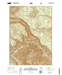
2020 Map of Shitike Butte
USGS Topo · Published 2020About this map
Metolius Wild and Scenic River carves a deep, winding path through the heart of this landscape, marking a sharp geological transition within the Deschutes National Forest. The map documents a complex drainage system where the Whitewater River and numerous creeks like Rainy Cr and Seekseequa Cr converge toward the larger river basin. Prominent volcanic landforms dominate the horizon, including the high point of Shitike Butte and the distinctive formations of Twin Buttes and Mid Butte.
Find a feature on this map
60 named features on this map. Tap any name to fly to it.
Don’t see what you’re looking for? This feature index may not catch every label — zoom into the map to look around manually.
Map Details
Editions of this 2020 Shitike Butte Map
This is the sole edition of this map. No revisions or reprints were ever made.
Other maps of this area

1927 · Mt. Jefferson
USGS Topo · 1:125,000

1928 · Madras
USGS Topo · 1:125,000

1930 · Mt. Jefferson
USGS Topo · 1:125,000

1931 · Madras
USGS Topo · 1:125,000

1955 · Bend
USGS Topo · 1:250,000

1957 · Bend
USGS Topo · 1:250,000

1958 · Bend
USGS Topo · 1:250,000

1961 · Whitewater River
USGS Topo · 1:62,500

1961 · Fort Butte
USGS Topo · 1:62,500

1962 · Metolius Bench
USGS Topo · 1:24,000