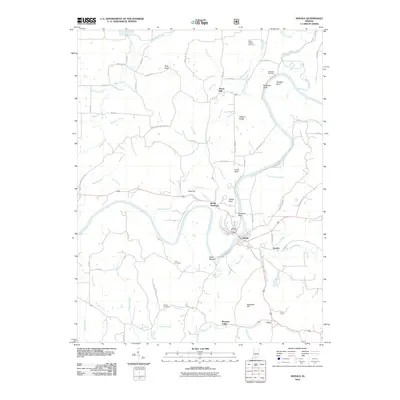
2010 Map of Shoals
USGS Topo · Published 2010About this map
The East Fork White River anchors this landscape, carving a deep, serpentine path through Martin County. This waterway is defined by its dramatic geological formations, including Pinnacle Rock, House Rock, and the sharp turn at Heathen Bend. Along its banks, the town of Shoals serves as the primary settlement, situated near the Shoals Overlook and the ancient site of Shell Mound. This river-centric geography historically dictated the placement of small communities like Ironton and Lacy, as well as several family-oriented burying grounds including McBrides Cemetery and Sholts Cemetery. The terrain is deeply dissected by numerous creeks and runs, such as Boggs Creek and Beaver Creek, which feed into the main river valley. This map captures a rural Indiana landscape where transport and community life remained closely tied to the natural contours of the river and its many tributaries.
Find a feature on this map
103 named features on this map. Tap any name to fly to it.
Don’t see what you’re looking for? This feature index may not catch every label — zoom into the map to look around manually.
Map Details
Editions of this 2010 Shoals Map
This is the sole edition of this map. No revisions or reprints were ever made.
Other maps of this area

1935 · Oolitic
USGS Topo · 1:48,000

1942 · Oolitic
USGS Topo · 1:62,500

1948 · Huron
USGS Topo · 1:24,000

1950 · Huron
USGS Topo · 1:24,000

1950 · Shoals
USGS Topo · 1:24,000

1950 · Odon
USGS Topo · 1:24,000

1951 · Hillham
USGS Topo · 1:24,000

1956 · Alfordsville
USGS Topo · 1:24,000

1956 · Loogootee
USGS Topo · 1:24,000

1956 · Rusk
USGS Topo · 1:24,000