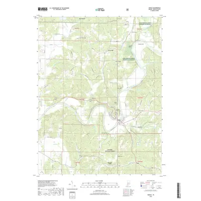
2019 Map of Shoals
USGS Topo · Published 2019About this map
The East Fork White River dictates the landscape of this Martin County region, winding through deep bends and passing significant landmarks like Pinnacle Rock and House Rock. The town of Shoals serves as a central hub, where the river's path is flanked by notable geological formations including Cedar Bluff and McBrides Bluff. Evidence of long-term human presence is visible from the Shell Mound near the riverbanks to the scattered rural settlements of Dover Hill, Ironton, and Lacy. Local history is preserved in several burial grounds such as Hollow Cem and Sholts Cem, while the northern reaches of the map include portions of the NSA Crane naval installation. The terrain is defined by a series of ridges and hollows, where water features like Mountain Stream and Buck Knob Cr drain into the primary river valley.
Find a feature on this map
121 named features on this map. Tap any name to fly to it.
Don’t see what you’re looking for? This feature index may not catch every label — zoom into the map to look around manually.
Map Details
Editions of this 2019 Shoals Map
This is the sole edition of this map. No revisions or reprints were ever made.
Other maps of this area

1935 · Oolitic
USGS Topo · 1:48,000

1942 · Oolitic
USGS Topo · 1:62,500

1948 · Huron
USGS Topo · 1:24,000

1950 · Huron
USGS Topo · 1:24,000

1950 · Shoals
USGS Topo · 1:24,000

1950 · Odon
USGS Topo · 1:24,000

1951 · Hillham
USGS Topo · 1:24,000

1956 · Alfordsville
USGS Topo · 1:24,000

1956 · Loogootee
USGS Topo · 1:24,000

1956 · Rusk
USGS Topo · 1:24,000