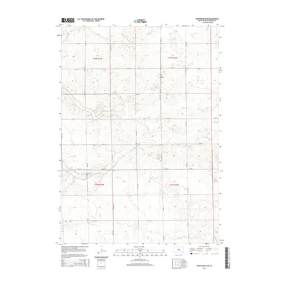
2015 Map of Shoemaker Dam
USGS Topo · Published 2015About this map
Twelvemile Cr meanders across this rural landscape in Davison County, defining the drainage patterns of the eastern South Dakota plains. The waterway is anchored by Shoemaker Dam, a local engineering feature that suggests a history of water management for agricultural or conservation purposes in this section of the Great Plains. The township is organized around a rigid grid of section-line roads, including 260th St and 407th Ave, typical of the region's land survey system. Local history is physically marked by the New Home Cem, located near the northern edge of the map, serving as a vital landmark for genealogists tracing early families of the area. The map illustrates the sparsely populated nature of the township, where the landscape is primarily dedicated to open acreage punctuated by these few notable community and infrastructure points.
Find a feature on this map
22 named features on this map. Tap any name to fly to it.
Don’t see what you’re looking for? This feature index may not catch every label — zoom into the map to look around manually.
Map Details
Editions of this 2015 Shoemaker Dam Map
This is the sole edition of this map. No revisions or reprints were ever made.
Other maps of this area

1898 · Olivet
USGS Topo · 1:125,000

1899 · Mitchell
USGS Topo · 1:125,000

1899 · Alexandria
USGS Topo · 1:125,000

1955 · Sioux Falls
USGS Topo · 1:250,000

1955 · Mitchell
USGS Topo · 1:250,000

1957 · Ethan
USGS Topo · 1:24,000

1957 · Riverside
USGS Topo · 1:24,000

1957 · Mitchell
USGS Topo · 1:24,000

1958 · Sioux Falls
USGS Topo · 1:250,000

1959 · Mitchell
USGS Topo · 1:250,000