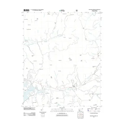
2011 Map of Shooting Creek
USGS Topo · Published 2011About this map
Elf and Shooting Creek anchor the southern reaches of this landscape, where the waters of Chatuge Lake meet a series of rugged ridges. The topography is defined by prominent elevations such as Galloway Mountain and The Pinnacle, with local family history reflected in landmarks like Galloway Hill Cemetery and Hogsed Cove. The northern terrain is a network of named gaps and ridges, including Tusquitee Gap and Gold Mine Ridge, which divide the numerous branches and creeks that feed the Nantahala River and Tusquitee Creek. Infrastructure such as Neal Cabe Dam at Neal Cabe Lake illustrates the management of local water resources within these narrow valleys. This area shows a pattern of settlement closely tied to the available flat land along corridors like Elf School Rd and Pounding Mill Loop, where small communities emerged between the steep slopes of Julie Ridge and Arch Ridge.
Find a feature on this map
134 named features on this map. Tap any name to fly to it.
Don’t see what you’re looking for? This feature index may not catch every label — zoom into the map to look around manually.
Map Details
Editions of this 2011 Shooting Creek Map
This is the sole edition of this map. No revisions or reprints were ever made.
Other maps of this area

1886 · Dahlonega
USGS Topo · 1:125,000

1892 · Dahlonega
USGS Topo · 1:125,000

1896 · Dahlonega
USGS Topo · 1:125,000

1903 · Dahlonega
USGS Topo · 1:125,000

1935 · Osborn
USGS Topo · 1:24,000

1935 · Rainbow Springs
USGS Topo · 1:24,000

1935 · Shooting Creek
USGS Topo · 1:24,000

1935 · Burningtown Bald
USGS Topo · 1:24,000

1935 · Topton
USGS Topo · 1:24,000

1935 · Wayah Bald
USGS Topo · 1:48,000