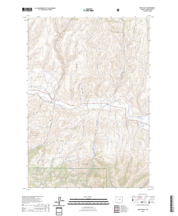
2023 Map of Shop Gulch
USGS Topo · Published 2023About this map
The Aldrich Mountains dominate the southern half of this landscape within the Malheur National Forest, where steep drainages and high ridges converge. The northern portion of the map is defined by the east-flowing John Day River, which is paralleled by the highway and fed by numerous seasonal and perennial streams including Fields Creek and Widows Creek. The presence of the Eddington Ditch near the river indicates the historic and ongoing management of water resources in this arid Grant County environment. The terrain rises sharply from the river valley toward prominent summits such as Coyote Butte and Horseshoe Butte. Along the southern boundary, Chrome Ridge and Big Canyon mark the transition into deeper forest land, while scattered springs like Lick Spring provide vital water points in the higher elevations. This map captures the intersection of early forest service road networks, like Fields Creek Rd, and the natural corridors that have shaped local transit for generations.
Find a feature on this map
39 named features on this map. Tap any name to fly to it.
Don’t see what you’re looking for? This feature index may not catch every label — zoom into the map to look around manually.
Map Details
Editions of this 2023 Shop Gulch Map
This is the sole edition of this map. No revisions or reprints were ever made.
Other maps of this area

1940 · Mount Vernon
USGS Topo · 1:62,500

1940 · Aldrich Mtn.
USGS Topo · 1:62,500

1943 · Aldrich Mtn.
USGS Topo · 1:62,500

1943 · Mount Vernon
USGS Topo · 1:62,500

1949 · Long Creek
USGS Topo · 1:62,500

1951 · Long Creek
USGS Topo · 1:62,500

1951 · Courtrock
USGS Topo · 1:62,500

1955 · Canyon City
USGS Topo · 1:250,000

1959 · Canyon City
USGS Topo · 1:250,000

1972 · Big Weasel Sprs
USGS Topo · 1:24,000