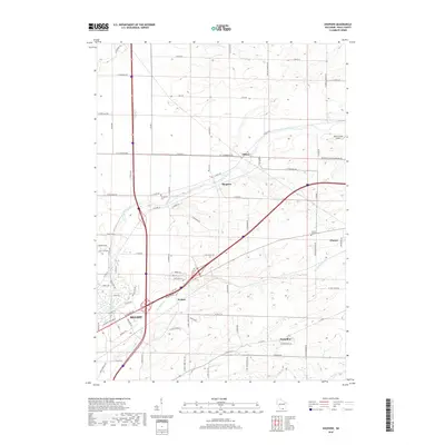
2018 Map of Shopiere
USGS Topo · Published 2018About this map
Turtle Creek winds through the heart of this Rock County landscape, connecting the small communities of Tiffany, Shopiere, and Porters. The map illustrates a rural environment defined by its watercourses and a regular grid of section lines and township roads. In the southwestern corner, the northern reaches of Beloit begin to emerge with more dense residential street patterns, while Clinton sits at the eastern edge. Local history is anchored by markers such as Turtleville Cem and Clinton Corners Cem, which reflect the area's long-established settlement. The landscape is primarily agricultural, punctuated by features like the Melin Farms Airport and the convergence of several major roads and rail lines near the creek, highlighting the region's importance as a transportation corridor between larger Wisconsin hubs.
Find a feature on this map
85 named features on this map. Tap any name to fly to it.
Don’t see what you’re looking for? This feature index may not catch every label — zoom into the map to look around manually.
Map Details
Editions of this 2018 Shopiere Map
This is the sole edition of this map. No revisions or reprints were ever made.
Other maps of this area

1891 · Janesville
USGS Topo · 1:62,500

1893 · Janesville
USGS Topo · 1:62,500

1893 · Shopiere
USGS Topo · 1:62,500

1918 · Rockford
USGS Topo · 1:62,500

1918 · Belvidere
USGS Topo · 1:62,500

1938 · Rockford
USGS Topo · 1:62,500

1944 · Belvidere
USGS Topo · 1:62,500

1954 · Rockford
USGS Topo · 1:250,000

1955 · Rockford
USGS Topo · 1:250,000

1958 · Rockford
USGS Topo · 1:250,000