2022 Map of Shopiere
USGS Topo · Published 2022About this map
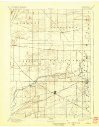
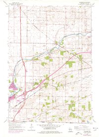
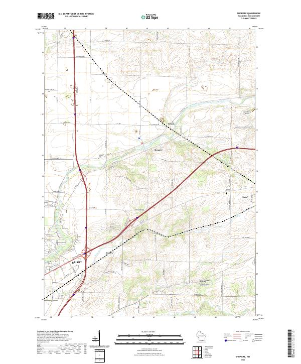
Beloit anchors the southwestern edge of this survey, where the modern transport corridor of the Interstate meets the historic agricultural lands of Rock County. The landscape is defined by the winding course of Turtle Creek, which passes through the small settlements of Tiffany and Shopiere. These communities reflect the early pattern of development along the waterway, while the surrounding grid of section lines and township roads—such as S Milton Shopiere Rd and Bradford-Clinton Townline Rd—illustrates the enduring structure of Wisconsin's dairy and farming country. Local history is well preserved in the placement of Turtleville Cem and Clinton Corners Cem, alongside smaller locales like Porters and Foxhollow. The map also captures specialized land uses, including the Melin Farms Airport, highlighting how the modern era has integrated aviation into the rural landscape.
Find a feature on this map
93 named features on this map. Tap any name to fly to it.
Don’t see what you’re looking for? This feature index may not catch every label — zoom into the map to look around manually.
Map Details
Editions of this 2022 Shopiere Map
This is the sole edition of this map. No revisions or reprints were ever made.
Historical Maps of Town of Turtle Through Time
4 maps found