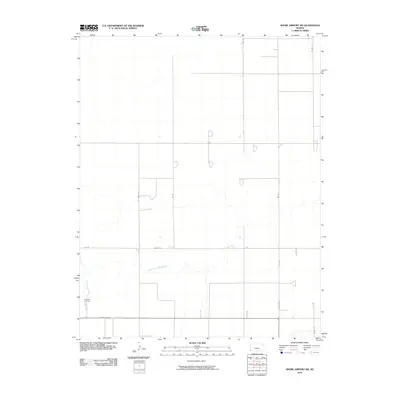
2010 Map of Shore Airport SW
USGS Topo · Published 2010About this map
The North Fork Cimarron River winds through this section of Morton County, carving a meandering path through the high plains landscape. This 2010 survey illustrates the rigid section-line grid typical of Western Kansas, where a network of rural roads such as Co Rd 24 and Z Rd connect isolated homesteads and agricultural plots. In the southwestern portion of the sheet, State Hwy 51 provides a primary east-west corridor, passing near the Richfield Cemetery, a significant landmark for those researching local family history. The drainage patterns of the river valley contrast sharply with the straight-line precision of W Rd and Co Rd W, reflecting the intersection of natural geography and human organization in this sparse prairie environment.
Find a feature on this map
11 named features on this map. Tap any name to fly to it.
Don’t see what you’re looking for? This feature index may not catch every label — zoom into the map to look around manually.
Map Details
Editions of this 2010 Shore Airport SW Map
This is the sole edition of this map. No revisions or reprints were ever made.
Other maps of this area

1955 · Dodge City
USGS Topo · 1:250,000

1958 · Dodge City
USGS Topo · 1:250,000

1959 · Dodge City
USGS Topo · 1:250,000

1973 · Shore Airport SW
USGS Topo · 1:24,000

1973 · Shore Airport
USGS Topo · 1:24,000

1973 · Rolla NW
USGS Topo · 1:24,000

1973 · Richfield NE
USGS Topo · 1:24,000

1973 · Elkhart NE
USGS Topo · 1:24,000

1973 · Rolla NE
USGS Topo · 1:24,000
1973 · Richfield
USGS Topo · 1:24,000