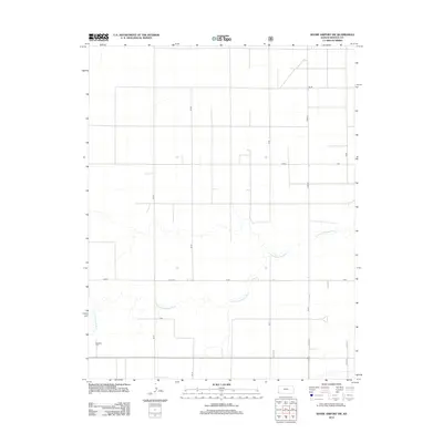
2012 Map of Shore Airport SW
USGS Topo · Published 2012About this map
The N Fork Cimarron River winds through the heart of this Morton County landscape, carving a natural path across the high plains. The river's meandering course provides the primary relief in an otherwise strictly surveyed grid of section roads and thoroughfares. Human presence is anchored in the southwest by the Richfield Cem, a significant marker for local genealogy and regional history. The map illustrates the 21st-century agricultural and transit framework of this Kansas borderland, where the intersection of Z Blvd and Road 23 serves as a modern waypoint. The transition from established paved routes like W Blvd to smaller local roads such as V Rd and Rd 20 highlights the organized rural infrastructure typical of the western edge of the state.
Find a feature on this map
19 named features on this map. Tap any name to fly to it.
Don’t see what you’re looking for? This feature index may not catch every label — zoom into the map to look around manually.
Map Details
Editions of this 2012 Shore Airport SW Map
This is the sole edition of this map. No revisions or reprints were ever made.
Other maps of this area

1955 · Dodge City
USGS Topo · 1:250,000

1958 · Dodge City
USGS Topo · 1:250,000

1959 · Dodge City
USGS Topo · 1:250,000

1973 · Shore Airport SW
USGS Topo · 1:24,000

1973 · Shore Airport
USGS Topo · 1:24,000

1973 · Rolla NW
USGS Topo · 1:24,000

1973 · Richfield NE
USGS Topo · 1:24,000

1973 · Elkhart NE
USGS Topo · 1:24,000

1973 · Rolla NE
USGS Topo · 1:24,000
1973 · Richfield
USGS Topo · 1:24,000