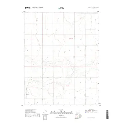
2018 Map of Shore Airport SW
USGS Topo · Published 2018About this map
The N Fork Cimarron River meanders across this High Plains landscape in southwestern Kansas, carving a distinct valley through the otherwise uniform topography of Morton County. This survey reflects the enduring grid of the Public Land Survey System, where section lines are literalized into a functional road network including Z Rd, W Rd, and V Rd. A significant historical and genealogical landmark, the Richfield Cem, sits in the southwestern portion of the map, serving as a quiet focal point for the surrounding rural area. The landscape is defined by this intersection of natural hydrology and man-made order, where the river's winding path provides the only break in the geometric precision of the township lines like t32s r41w and t31s r40w.
Find a feature on this map
17 named features on this map. Tap any name to fly to it.
Don’t see what you’re looking for? This feature index may not catch every label — zoom into the map to look around manually.
Map Details
Editions of this 2018 Shore Airport SW Map
This is the sole edition of this map. No revisions or reprints were ever made.
Other maps of this area

1955 · Dodge City
USGS Topo · 1:250,000

1958 · Dodge City
USGS Topo · 1:250,000

1959 · Dodge City
USGS Topo · 1:250,000

1973 · Shore Airport SW
USGS Topo · 1:24,000

1973 · Shore Airport
USGS Topo · 1:24,000

1973 · Rolla NW
USGS Topo · 1:24,000

1973 · Richfield NE
USGS Topo · 1:24,000

1973 · Elkhart NE
USGS Topo · 1:24,000

1973 · Rolla NE
USGS Topo · 1:24,000
1973 · Richfield
USGS Topo · 1:24,000