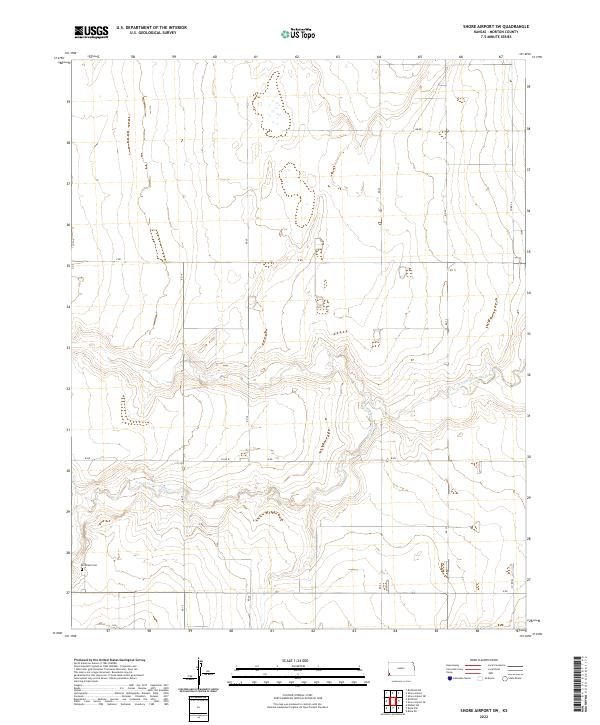
2022 Map of Shore Airport SW
USGS Topo · Published 2022About this map
The N Fork Cimarron River carves a winding path through this corner of Morton County, defining the drainage patterns of an otherwise orderly agricultural landscape. This portion of southwest Kansas is characterized by its rigid sectional grid, where long rural routes such as RD 19 and RD 20 intersect with lateral paths like Z RD and W RD. These roads represent the essential infrastructure of the High Plains, connecting remote farmsteads to the larger region. In the southwestern corner of the quadrangle, the Richfield Cem serves as a significant landmark for genealogists and local historians, anchoring the history of the families who settled this territory. The terrain is marked by subtle elevation changes near the riverbed, providing a contrast to the surrounding plateau where grain farming and ranching are the primary drivers of the local economy.
Find a feature on this map
13 named features on this map. Tap any name to fly to it.
Don’t see what you’re looking for? This feature index may not catch every label — zoom into the map to look around manually.
Map Details
Editions of this 2022 Shore Airport SW Map
This is the sole edition of this map. No revisions or reprints were ever made.
Other maps of this area

1955 · Dodge City
USGS Topo · 1:250,000

1958 · Dodge City
USGS Topo · 1:250,000

1959 · Dodge City
USGS Topo · 1:250,000

1973 · Shore Airport SW
USGS Topo · 1:24,000

1973 · Shore Airport
USGS Topo · 1:24,000

1973 · Rolla NW
USGS Topo · 1:24,000

1973 · Richfield NE
USGS Topo · 1:24,000

1973 · Elkhart NE
USGS Topo · 1:24,000

1973 · Rolla NE
USGS Topo · 1:24,000
1973 · Richfield
USGS Topo · 1:24,000