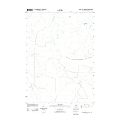
2012 Map of Short Bow Creek East
USGS Topo · Published 2012About this map
Cedar Butte rises as a prominent landmark above the intricate drainage network of Jackson County, anchoring a landscape defined by the winding paths of Short Bow Cr and Cottonwood Cr. This 2012 USGS survey of the South Dakota plains reveals a topography carved by water, where the expansive Cottonwood Basin meets a series of smaller tributaries including Red Stone Cr, Corn Cr, and Fish Cr. The map captures the rural character of the region during the early 21st century, showing the established grid of local roads such as CS 73 and CS 71 that connect this area of the High Plains. It is a detailed representation of the hydrological patterns and landforms that have shaped ranching and settlement in the vicinity of Wanblee, South Dakota.
Find a feature on this map
12 named features on this map. Tap any name to fly to it.
Don’t see what you’re looking for? This feature index may not catch every label — zoom into the map to look around manually.
Map Details
Editions of this 2012 Short Bow Creek East Map
This is the sole edition of this map. No revisions or reprints were ever made.
Other maps of this area

1951 · Pass Creek NW
USGS Topo · 1:24,000

1951 · Cedar Butte NW
USGS Topo · 1:24,000

1951 · Pass Creek NE
USGS Topo · 1:24,000

1955 · Martin
USGS Topo · 1:250,000

1958 · Martin
USGS Topo · 1:250,000

1969 · Norris
USGS Topo · 1:24,000

1980 · Kadoka
USGS Topo · 1:100,000

1981 · Cedar Butte
USGS Topo · 1:25,000

1981 · Long Valley
USGS Topo · 1:25,000
1981 · Short Bow Creek
USGS Topo · 1:25,000