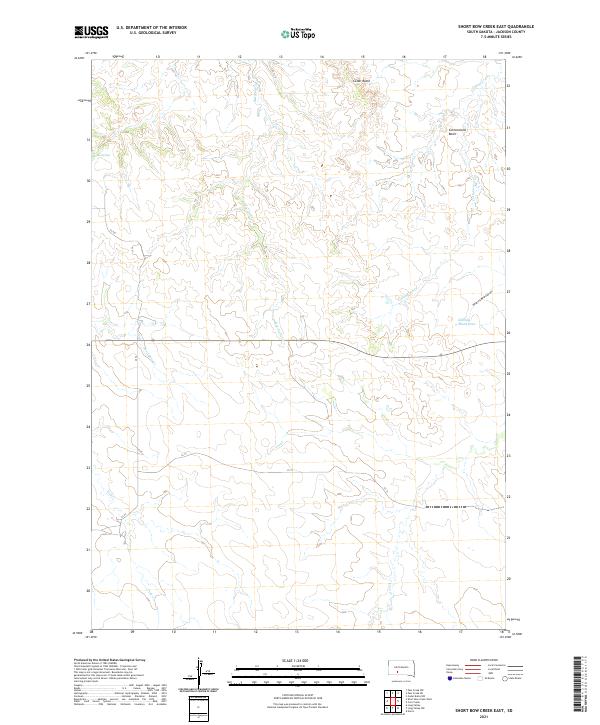
2021 Map of Short Bow Creek East
USGS Topo · Published 2021About this map
Cedar Butte overlooks a terrain defined by complex drainage networks and wide basins in this corner of Jackson County. The landscape is primarily shaped by the intermittent flows of Red Stone Cr and Cottonwood Cr, which snake through the northern sections before reaching the Cottonwood Basin. Toward the southeast, the uniquely named Klinking Beard Draw cuts into the plains, providing a distinct geographic landmark alongside the headwaters of Corn Cr.
Find a feature on this map
16 named features on this map. Tap any name to fly to it.
Don’t see what you’re looking for? This feature index may not catch every label — zoom into the map to look around manually.
Map Details
Editions of this 2021 Short Bow Creek East Map
This is the sole edition of this map. No revisions or reprints were ever made.
Other maps of this area

1951 · Pass Creek NW
USGS Topo · 1:24,000

1951 · Cedar Butte NW
USGS Topo · 1:24,000

1951 · Pass Creek NE
USGS Topo · 1:24,000

1955 · Martin
USGS Topo · 1:250,000

1958 · Martin
USGS Topo · 1:250,000

1969 · Norris
USGS Topo · 1:24,000

1980 · Kadoka
USGS Topo · 1:100,000

1981 · Cedar Butte
USGS Topo · 1:25,000

1981 · Long Valley
USGS Topo · 1:25,000
1981 · Short Bow Creek
USGS Topo · 1:25,000