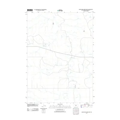
2012 Map of Short Bow Creek West
USGS Topo · Published 2012About this map
Pass Creek Basin and the surrounding high plains of Jackson County are defined by a complex drainage network feeding into the Pass Creek. This early 21st-century topography illustrates a landscape carved by seasonal waterways like Settin Up Creek and Short Bow Creek, which dictate the placement of ranch roads such as Pass Creek Road. The presence of named landmarks like Half Dome and several freshwater sources, including Hill Spring and Rooks Spring, indicates the vital importance of water management and topography in this part of South Dakota. The map captures the intersection of natural hydrology and modern infrastructure, shown through the alignment of County Road 15 against the winding paths of Buzzard Creek and Waterhole Creek.
Find a feature on this map
18 named features on this map. Tap any name to fly to it.
Don’t see what you’re looking for? This feature index may not catch every label — zoom into the map to look around manually.
Map Details
Editions of this 2012 Short Bow Creek West Map
This is the sole edition of this map. No revisions or reprints were ever made.
Other maps of this area

1951 · Pass Creek NW
USGS Topo · 1:24,000

1951 · Wanblee NE
USGS Topo · 1:24,000

1951 · Pass Creek NE
USGS Topo · 1:24,000

1955 · Martin
USGS Topo · 1:250,000

1958 · Martin
USGS Topo · 1:250,000

1980 · Kadoka
USGS Topo · 1:100,000

1981 · Long Valley
USGS Topo · 1:25,000

1981 · Broken Leg Dam
USGS Topo · 1:24,000
1981 · Short Bow Creek
USGS Topo · 1:25,000
1981 · Buzzard Butte
USGS Topo · 1:25,000