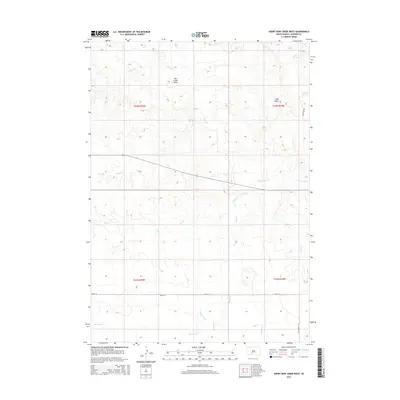
2015 Map of Short Bow Creek West
USGS Topo · Published 2015About this map
Pass Creek Basin defines the central topography of this Jackson County landscape, where a dense network of seasonal drainages converges. The terrain is marked by distinct landmarks such as Half Dome and a series of vital water sources including Hill Spring, North Spring, and Rooks Spring. These features suggest a landscape where water management and natural catchments were primary to local navigation and land use. The southern portion of the sheet is crisscrossed by several prominent creeks, most notably Settin Up Cr, Buzzard Cr, and Waterhole Cr, which emphasize the dendritic drainage patterns of the region. Local infrastructure is minimal, represented primarily by 268th St and Fish Creek Rd, indicating a contemporary era of rural land management and ranching connectivity.
Find a feature on this map
20 named features on this map. Tap any name to fly to it.
Don’t see what you’re looking for? This feature index may not catch every label — zoom into the map to look around manually.
Map Details
Editions of this 2015 Short Bow Creek West Map
This is the sole edition of this map. No revisions or reprints were ever made.
Other maps of this area

1951 · Pass Creek NW
USGS Topo · 1:24,000

1951 · Wanblee NE
USGS Topo · 1:24,000

1951 · Pass Creek NE
USGS Topo · 1:24,000

1955 · Martin
USGS Topo · 1:250,000

1958 · Martin
USGS Topo · 1:250,000

1980 · Kadoka
USGS Topo · 1:100,000

1981 · Long Valley
USGS Topo · 1:25,000

1981 · Broken Leg Dam
USGS Topo · 1:24,000
1981 · Short Bow Creek
USGS Topo · 1:25,000
1981 · Buzzard Butte
USGS Topo · 1:25,000