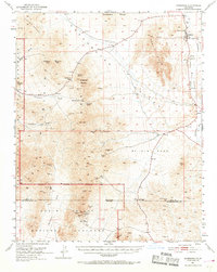
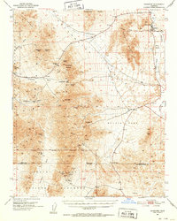
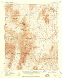
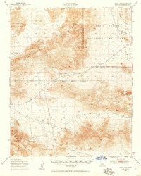
1951 Map of Shoshone
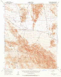
USGS Topo · Published 1969About this map
Mining operations and water sources define this mid-century look at the southern edges of Death Valley National Monument. The settlement of Shoshone serves as a lone hub along the Amargosa River, marked by its local Cem and vital springs like Shoshone Spr. The landscape is a network of prospector tracks leading to numerous claims, including the Ibex Mine, Paddys Pride Mine, and American Mine.
Find a feature on this map
49 named features on this map. Tap any name to fly to it.
Don’t see what you’re looking for? This feature index may not catch every label — zoom into the map to look around manually.
Map Details
Editions of this 1951 Shoshone Map
3 editions found
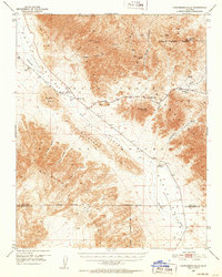
Other maps of this area

1908 · Furnace Creek
USGS Topo · 1:250,000

1910 · Furnace Creek
USGS Topo · 1:250,000

1933 · Avawatz Mountains
USGS Topo · 1:250,000
1940 · Eagle Tank
USGS Topo · 1:62,500

1947 · Trona
USGS Topo · 1:250,000

1948 · Trona
USGS Topo · 1:250,000

1948 · Death Valley
USGS Topo · 1:250,000
1948 · Leach Lake
USGS Topo · 1:62,500
1948 · Avawatz Pass
USGS Topo · 1:62,500
1950 · Confidence Hills
USGS Topo · 1:62,500