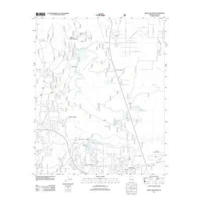
2011 Map of Show Low North
USGS Topo · Published 2011About this map
Show Low Creek serves as the central drainage for this high-country landscape, flowing northward through a series of significant crossings and canyons. The settlement patterns shown here reflect a transition from rural ranching roots, evidenced by the Pearce Ranch and historic sites like Robinson / Trail Crossing, to modern civic infrastructure near the southern margin. The development of Show Low is marked by the presence of the Show Low Post Office and the Show Low Municipal Airport, while recreation is centered around Fools Hollow Lake and its associated Fools Hollow Campground. To the north, the terrain becomes more industrial and open, featuring the Lone Pine Gravel Pit and the prominent White Lake Divide. Numerous tanks and reservoirs, such as Pintail Lake and Telephone Lake, underscore the importance of water management in this arid Navajo County environment.
Find a feature on this map
144 named features on this map. Tap any name to fly to it.
Don’t see what you’re looking for? This feature index may not catch every label — zoom into the map to look around manually.
Map Details
Editions of this 2011 Show Low North Map
This is the sole edition of this map. No revisions or reprints were ever made.
Other maps of this area

1886 · St Johns
USGS Topo · 1:250,000

1886 · Holbrook
USGS Topo · 1:250,000

1892 · St Johns
USGS Topo · 1:250,000

1893 · Holbrook
USGS Topo · 1:250,000

1954 · Holbrook
USGS Topo · 1:250,000

1954 · Saint Johns
USGS Topo · 1:250,000

1957 · Holbrook
USGS Topo · 1:250,000

1957 · Saint Johns
USGS Topo · 1:250,000

1958 · Saint Johns
USGS Topo · 1:250,000

1958 · Holbrook
USGS Topo · 1:250,000