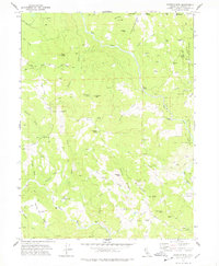
1978 Map of Showers Mtn
USGS Topo · Published 1978About this map
Ackley Ranch serves as a historical anchor on this landscape, marking the site of a frontier-era military post near the southern edge of the survey. The map details a remote section of Humboldt County where family-named properties like Stapp Ranch, Singleton Ranch, and Becham Cabin are scattered across the mountainous terrain of the Six Rivers National Forest.
Find a feature on this map
55 named features on this map. Tap any name to fly to it.
Don’t see what you’re looking for? This feature index may not catch every label — zoom into the map to look around manually.
Map Details
Editions of this 1978 Showers Mtn Map
2 editions found
Other maps of this area

1914 · Pilot Creek
USGS Topo · 1:62,500

1915 · Big Bar and Vicinity
USGS Topo · 1:250,000

1921 · Dyerville
USGS Topo · 1:62,500

1922 · Kneeland
USGS Topo · 1:62,500

1949 · Blocksburg
USGS Topo · 1:62,500

1949 · Weott
USGS Topo · 1:62,500

1950 · Iaqua Buttes
USGS Topo · 1:62,500

1951 · Weott
USGS Topo · 1:62,500

1951 · Blocksburg
USGS Topo · 1:62,500

1951 · Pilot Creek
USGS Topo · 1:62,500