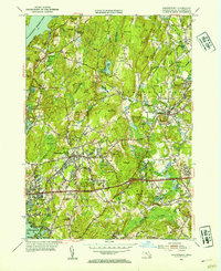
1953 Map of Shrewsbury
USGS Topo · Published 1954About this map
The Wachusett Reservoir dominates the northwestern corner of this landscape, its shoreline defining the edges of Boylston Center and the surrounding hills. This mid-century survey reveals a region transitioning from its agricultural roots into a more complex network of institutions and suburban infrastructure. The presence of specialized facilities like the Grafton State Hospital, Massic Hospital, and the Lyman State Sch indicates the area's historical role in providing large-scale public health and educational services for central Massachusetts.
Find a feature on this map
80 named features on this map. Tap any name to fly to it.
Don’t see what you’re looking for? This feature index may not catch every label — zoom into the map to look around manually.
Map Details
Editions of this 1953 Shrewsbury Map
3 editions found
Other maps of this area

1885 · Worcester
USGS Topo · 1:62,500

1886 · Worcester
USGS Topo · 1:62,500

1886 · Blackstone
USGS Topo · 1:62,500

1887 · Marlboro
USGS Topo · 1:62,500

1889 · Marlboro
USGS Topo · 1:62,500

1889 · Blackstone
USGS Topo · 1:62,500

1889 · Webster
USGS Topo · 1:62,500

1892 · Webster
USGS Topo · 1:62,500

1892 · Worcester
USGS Topo · 1:62,500

1893 · Blackstone
USGS Topo · 1:62,500