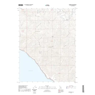
2021 Map of Shubrick Peak
USGS Topo · Published 2021About this map
Shubrick Peak and the surrounding King Range define this stretch of the Northern California coastline, where the land drops precipitously into the Pacific Ocean. This survey captures the wilderness character of the region as it appeared in the early 21st century, dominated by steep ridges and deep gulches. The Lost Coast Trl winds along the shoreline, connecting coastal benches like Big Flat and Miller Flat at the base of Rattlesnake Ridge.
Find a feature on this map
58 named features on this map. Tap any name to fly to it.
Don’t see what you’re looking for? This feature index may not catch every label — zoom into the map to look around manually.
Map Details
Editions of this 2021 Shubrick Peak Map
This is the sole edition of this map. No revisions or reprints were ever made.
Other maps of this area

1919 · Glynn
USGS Topo · 1:62,500

1920 · Pt. Delagda
USGS Topo · 1:62,500

1921 · Cape Mendocino
USGS Topo · 1:62,500

1926 · Gorda
USGS Topo · 1:62,500

1949 · Eureka
USGS Topo · 1:250,000

1949 · Point Delgada
USGS Topo · 1:62,500

1950 · Cape Mendocino
USGS Topo · 1:62,500

1950 · Scotia
USGS Topo · 1:62,500

1951 · Scotia
USGS Topo · 1:62,500

1951 · Point Delgada
USGS Topo · 1:62,500