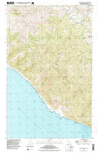
1997 Map of Shubrick Peak
USGS Topo · Published 1999About this map
The King Range National Conservation Area dominates this coastal landscape, where the land rises sharply from the Pacific Ocean to the high crests of the King Range. This map captures a wilderness terrain characterized by a dense network of ridges such as Moody Ridge, Telegraph Ridge, and Tan Oak Ridge. A notable human element in this remote environment is the Landing Strip situated on the coastal terrace of Big Flat, providing one of the few level access points along this stretch of the Lost Coast. Further south, Miller Flat and the offshore Black Rock mark the rugged transition between the mountains and the sea.
Find a feature on this map
46 named features on this map. Tap any name to fly to it.
Don’t see what you’re looking for? This feature index may not catch every label — zoom into the map to look around manually.
Map Details
Editions of this 1997 Shubrick Peak Map
This is the sole edition of this map. No revisions or reprints were ever made.
Other maps of this area

1919 · Glynn
USGS Topo · 1:62,500

1920 · Pt. Delagda
USGS Topo · 1:62,500

1921 · Cape Mendocino
USGS Topo · 1:62,500

1926 · Gorda
USGS Topo · 1:62,500

1949 · Eureka
USGS Topo · 1:250,000

1949 · Point Delgada
USGS Topo · 1:62,500

1950 · Cape Mendocino
USGS Topo · 1:62,500

1950 · Scotia
USGS Topo · 1:62,500

1951 · Scotia
USGS Topo · 1:62,500

1951 · Point Delgada
USGS Topo · 1:62,500