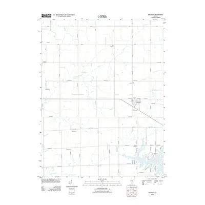
2012 Map of Shumway
USGS Topo · Published 2012About this map
Shumway sits at the heart of this Effingham County landscape, where the agricultural grid is etched with several named family farms including Wendte Farms, Wachtel Farms, and Laue Farms. The settlement of Holland appears in the northwest, while the southern portion of the quadrangle is defined by the reaching fingers of Lake Sara. This reservoir is fed by a complex drainage network that includes Blue Point Cr, Morris Cr, and Lily Cr. For genealogists, the map is particularly detailed regarding local burial sites, documenting Trinity Lutheran Cem, Saint Marys Cem, and Blue Point Baptist Cem, alongside several others. The terrain is further marked by numerous watercourses like Wolf Cr and Shoal Cr, which break the geometric regularity of the rural roads.
Find a feature on this map
76 named features on this map. Tap any name to fly to it.
Don’t see what you’re looking for? This feature index may not catch every label — zoom into the map to look around manually.
Map Details
Editions of this 2012 Shumway Map
This is the sole edition of this map. No revisions or reprints were ever made.
Other maps of this area

1941 · St. Elmo
USGS Topo · 1:62,500

1942 · Shelbyville
USGS Topo · 1:62,500

1945 · St. Elmo
USGS Topo · 1:62,500

1946 · Shelbyville
USGS Topo · 1:62,500

1947 · Stewardson
USGS Topo · 1:62,500

1949 · Stewardson
USGS Topo · 1:62,500

1950 · Effingham
USGS Topo · 1:62,500

1951 · Effingham
USGS Topo · 1:62,500

1958 · Decatur
USGS Topo · 1:250,000

1961 · Decatur
USGS Topo · 1:250,000