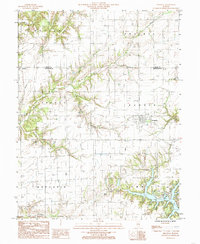
1985 Map of Shumway
USGS Topo · Published 1985About this map
Shumway sits at the heart of this central Illinois landscape, surrounded by the fertile expanse of the Holland Prairie. The map documents a rural environment shaped by numerous watercourses, including Shoal Creek and Wolf Creek, which carve through the townships of Liberty, Banner, and Prairie. In the southern portion of the sheet, the development of Lake Sara introduces a significant recreational geography, complete with a Public Boat Landing, a Camp Ground, and a Golf Course. This 1980s-era study illustrates the persistent township structure and the agricultural drainage patterns of Moccasin and Summit townships. Traces of local history are found in the small settlement of Holland and the scattered Cem locations that dot the countryside, reflecting the generations of farming families who settled along the banks of Moccasin Creek and Blue Point Creek.
Find a feature on this map
26 named features on this map. Tap any name to fly to it.
Don’t see what you’re looking for? This feature index may not catch every label — zoom into the map to look around manually.
Map Details
Editions of this 1985 Shumway Map
This is the sole edition of this map. No revisions or reprints were ever made.
Other maps of this area

1941 · St. Elmo
USGS Topo · 1:62,500

1942 · Shelbyville
USGS Topo · 1:62,500

1945 · St. Elmo
USGS Topo · 1:62,500

1946 · Shelbyville
USGS Topo · 1:62,500

1947 · Stewardson
USGS Topo · 1:62,500

1949 · Stewardson
USGS Topo · 1:62,500

1950 · Effingham
USGS Topo · 1:62,500

1951 · Effingham
USGS Topo · 1:62,500

1958 · Decatur
USGS Topo · 1:250,000

1961 · Decatur
USGS Topo · 1:250,000