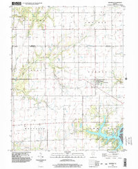
1998 Map of Shumway
USGS Topo · Published 2003About this map
Shumway anchors the eastern edge of this Effingham County landscape, situated where the open plains of Banner and Prairie townships meet a network of descending creek valleys. The settlement pattern is defined by a grid of rural roads and scattered farmsteads, concentrated around small hubs like Holland in the northwest. To the southeast, the terrain shifts significantly as it reaches the northern fingers of Lake Sara, where the presence of a Boat Ramp and a Golf Course indicates the area's transition toward recreation and residential development.
Find a feature on this map
22 named features on this map. Tap any name to fly to it.
Don’t see what you’re looking for? This feature index may not catch every label — zoom into the map to look around manually.
Map Details
Editions of this 1998 Shumway Map
This is the sole edition of this map. No revisions or reprints were ever made.
Other maps of this area

1941 · St. Elmo
USGS Topo · 1:62,500

1942 · Shelbyville
USGS Topo · 1:62,500

1945 · St. Elmo
USGS Topo · 1:62,500

1946 · Shelbyville
USGS Topo · 1:62,500

1947 · Stewardson
USGS Topo · 1:62,500

1949 · Stewardson
USGS Topo · 1:62,500

1950 · Effingham
USGS Topo · 1:62,500

1951 · Effingham
USGS Topo · 1:62,500

1958 · Decatur
USGS Topo · 1:250,000

1961 · Decatur
USGS Topo · 1:250,000