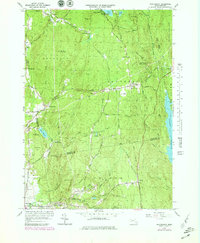
1964 Map of Shutesbury
USGS Topo · Published 1979About this map
Shutesbury and the surrounding highland townships of Leverett, Pelham, and New Salem are defined here by a network of upland reservoirs and small village centers. The eastern edge of the map is dominated by the shoreline of the Quabbin Reservoir, a massive public works project that altered the geography of the Swift River Valley. Local education and community life are marked by the Shutesbury Center School and the Town Consolidated School in Leverett.
Find a feature on this map
83 named features on this map. Tap any name to fly to it.
Don’t see what you’re looking for? This feature index may not catch every label — zoom into the map to look around manually.
Map Details
Editions of this 1964 Shutesbury Map
4 editions found
Other maps of this area

1885 · Northampton
USGS Topo · 1:62,500

1886 · Northampton
USGS Topo · 1:62,500

1887 · Warwick
USGS Topo · 1:62,500

1887 · Belchertown
USGS Topo · 1:62,500

1889 · Warwick
USGS Topo · 1:62,500

1890 · Belchertown
USGS Topo · 1:62,500

1890 · Greenfield
USGS Topo · 1:62,500

1891 · Northampton
USGS Topo · 1:62,500

1893 · Northampton
USGS Topo · 1:62,500

1893 · Belchertown
USGS Topo · 1:62,500