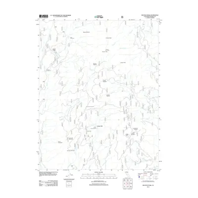
2012 Map of Shuteye Peak
USGS Topo · Published 2012About this map
Central Camp serves as a primary point of human activity in this high-elevation landscape of Madera County, defined by a network of forest roads and remote campgrounds. The terrain is marked by significant peaks and ridges, including Shuteye Peak with its Shuteye Peak Lookout and Peckinpah Mountain to the southwest. This area is characterized by numerous meadows such as Morgan Meadow, Browns Meadow, and Haskell Meadow, which suggest a history of seasonal grazing or natural clearings within the dense drainage systems of Sand Cr and Whisky Cr. Small outposts like Whites Cabin and the waterfall at Whisky Falls indicate a region shaped by both recreational use and early timber or ranching infrastructure. The intricate web of Forest Service routes, including RD 8007 and RD 8009, provides access to these isolated sites across the Sierra Nevada high country.
Find a feature on this map
43 named features on this map. Tap any name to fly to it.
Don’t see what you’re looking for? This feature index may not catch every label — zoom into the map to look around manually.
Map Details
Editions of this 2012 Shuteye Peak Map
This is the sole edition of this map. No revisions or reprints were ever made.
Other maps of this area

1904 · Kaiser
USGS Topo · 1:125,000

1912 · Mariposa
USGS Topo · 1:125,000

1942 · Millerton Lake
USGS Topo · 1:62,500

1945 · Millerton Lake
USGS Topo · 1:62,500

1947 · Mariposa
USGS Topo · 1:250,000

1948 · Mariposa
USGS Topo · 1:250,000
1953 · Bass Lake
USGS Topo · 1:62,500

1953 · Shaver Lake
USGS Topo · 1:62,500

1953 · Shuteye Peak
USGS Topo · 1:62,500

1957 · Mariposa
USGS Topo · 1:250,000