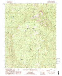
1990 Map of Shuteye Peak
USGS Topo · Published 1990About this map
Central Camp serves as a primary point of reference in this high-altitude landscape within the Sierra National Forest. The map documents a rugged interior characterized by extensive meadow systems and significant vertical relief, anchored by the prominent Shuteye Peak and its associated Shuteye Peak Lookout Tower. Settlement in the late 20th century is represented through a network of seasonal outposts and recreational sites, including Whites Cabin and several remote campsites like Whiskers Campground and Whiskey Falls Campground.
Find a feature on this map
40 named features on this map. Tap any name to fly to it.
Don’t see what you’re looking for? This feature index may not catch every label — zoom into the map to look around manually.
Map Details
Editions of this 1990 Shuteye Peak Map
This is the sole edition of this map. No revisions or reprints were ever made.
Other maps of this area

1904 · Kaiser
USGS Topo · 1:125,000

1912 · Mariposa
USGS Topo · 1:125,000

1942 · Millerton Lake
USGS Topo · 1:62,500

1945 · Millerton Lake
USGS Topo · 1:62,500

1947 · Mariposa
USGS Topo · 1:250,000

1948 · Mariposa
USGS Topo · 1:250,000
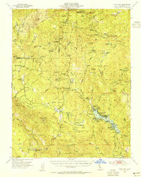
1953 · Bass Lake
USGS Topo · 1:62,500

1953 · Shaver Lake
USGS Topo · 1:62,500

1953 · Shuteye Peak
USGS Topo · 1:62,500

1957 · Mariposa
USGS Topo · 1:250,000