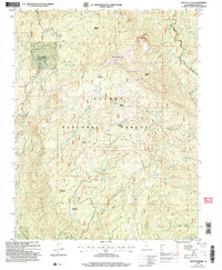
2004 Map of Shuteye Peak
USGS Topo · Published 2007About this map
Shuteye Peak Lookout crowns the high elevation of this high Sierra landscape, overseeing a complex network of ridges and drainages within the Sierra National Forest. The map documents a rugged terrain shaped by timber history and recreation, anchored by Central Camp and several backcountry outposts like Whiskers, Gaggs, and Whites Cabin. These locations, alongside the Camp 5 Campsite, suggest a long-standing pattern of seasonal use and forestry management in the Madera County backcountry.
Find a feature on this map
38 named features on this map. Tap any name to fly to it.
Don’t see what you’re looking for? This feature index may not catch every label — zoom into the map to look around manually.
Map Details
Editions of this 2004 Shuteye Peak Map
This is the sole edition of this map. No revisions or reprints were ever made.
Other maps of this area

1904 · Kaiser
USGS Topo · 1:125,000

1912 · Mariposa
USGS Topo · 1:125,000

1942 · Millerton Lake
USGS Topo · 1:62,500

1945 · Millerton Lake
USGS Topo · 1:62,500

1947 · Mariposa
USGS Topo · 1:250,000

1948 · Mariposa
USGS Topo · 1:250,000
1953 · Bass Lake
USGS Topo · 1:62,500

1953 · Shaver Lake
USGS Topo · 1:62,500

1953 · Shuteye Peak
USGS Topo · 1:62,500

1957 · Mariposa
USGS Topo · 1:250,000