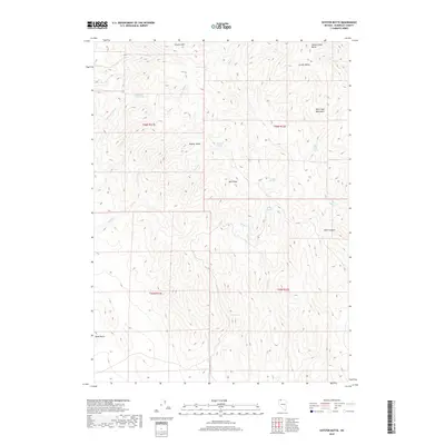
2018 Map of Shyster Butte
USGS Topo · Published 2018About this map
Shyster Butte and the Bilk Creek Mountains anchor this high-desert landscape in northern Humboldt County. This 2018 survey documents a region defined by its vital water sources, where numerous isolated points like Summit Spring, Little Sage Hen Spring, and Texas Springs provided essential stops for livestock and travelers in an arid environment. The drainage network is clearly delineated, showing how S Shyster Cr and N Shyster Cr converge to form Shyster Cr before it winds through the southern terrain. The map's detail reveals the naming of landforms that reflect local history and utility, such as Lovely Valley and Black Canyon, alongside prominent peaks like Granite Mtn and Split Peak. For those studying the geography of Nevada's remote basins, this map provides a precise account of how terrain features and reliable springs dictate the movement through this high country.
Find a feature on this map
28 named features on this map. Tap any name to fly to it.
Don’t see what you’re looking for? This feature index may not catch every label — zoom into the map to look around manually.
Map Details
Editions of this 2018 Shyster Butte Map
This is the sole edition of this map. No revisions or reprints were ever made.
Other maps of this area

1886 · Disaster
USGS Topo · 1:250,000

1893 · Disaster
USGS Topo · 1:250,000

1954 · Vya
USGS Topo · 1:250,000

1958 · Vya
USGS Topo · 1:250,000

1961 · Quinn River Crossing
USGS Topo · 1:62,500

1961 · Trident Peak
USGS Topo · 1:62,500

1962 · Vya
USGS Topo · 1:250,000

1965 · Duffer Peak
USGS Topo · 1:62,500

1966 · Denio
USGS Topo · 1:62,500

1979 · Denio
USGS Topo · 1:100,000