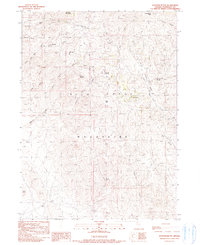
1990 Map of Shyster Butte
USGS Topo · Published 1990About this map
Bilk Creek Mountains dominate this high-altitude landscape in Humboldt County, where water sources dictate the geography of human activity and survival. The drainage network is anchored by Shyster Creek and Bilk Creek, with the rugged terrain punctuated by prominent high points like Shyster Butte, Granite Mountain, and Black Butte. This 1990 provisional survey, based on 1980s aerial photography and field checks, highlights a ranching or grazing environment where named springs provide the most vital landmarks. Historically significant water sources such as Etchart Springs, Gartiez Spring, and Texas Springs are meticulously mapped alongside remote features like Lovely Valley Creek and Summit Spring. The absence of developed towns and the presence of numerous stock ponds and springs suggest a landscape dedicated to seasonal livestock range, where reliable water points like Little Sage Hen Spring were essential for operations in the Great Basin interior.
Find a feature on this map
21 named features on this map. Tap any name to fly to it.
Don’t see what you’re looking for? This feature index may not catch every label — zoom into the map to look around manually.
Map Details
Editions of this 1990 Shyster Butte Map
This is the sole edition of this map. No revisions or reprints were ever made.
Other maps of this area

1886 · Disaster
USGS Topo · 1:250,000

1893 · Disaster
USGS Topo · 1:250,000

1954 · Vya
USGS Topo · 1:250,000

1958 · Vya
USGS Topo · 1:250,000

1961 · Quinn River Crossing
USGS Topo · 1:62,500

1961 · Trident Peak
USGS Topo · 1:62,500

1962 · Vya
USGS Topo · 1:250,000

1965 · Duffer Peak
USGS Topo · 1:62,500

1966 · Denio
USGS Topo · 1:62,500

1979 · Denio
USGS Topo · 1:100,000