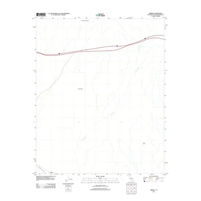
2012 Map of Siberia
USGS Topo · Published 2012About this map
The Siberia settlement sits at the southern edge of this Mojave Desert landscape, marking a remote outpost along the National Trails Hwy. This historic road, once the primary transcontinental artery, runs parallel to the modern corridor of Interstate 40. The topography is dominated by the intricate drainage systems of Siberia Wash, which carries runoff from the Bristol Mountains in the north toward the southern basins. Between these geographic points lie distinctive geological formations including Black Ridge and the volcanic terrain of the Lava Hills. The map reflects a landscape defined by aridity and movement, where historical travel routes intersect with the natural flow of desert washes and the steep relief of ancient mountain ranges.
Find a feature on this map
7 named features on this map. Tap any name to fly to it.
Don’t see what you’re looking for? This feature index may not catch every label — zoom into the map to look around manually.
Map Details
Editions of this 2012 Siberia Map
This is the sole edition of this map. No revisions or reprints were ever made.
Other maps of this area

1942 · Amboy
USGS Topo · 1:250,000

1943 · Amboy
USGS Topo · 1:250,000

1953 · San Bernardino
USGS Topo · 1:250,000

1954 · Needles
USGS Topo · 1:250,000

1954 · Amboy Crater
USGS Topo · 1:24,000

1954 · Bagdad SW
USGS Topo · 1:24,000

1954 · Ludlow SE
USGS Topo · 1:24,000

1955 · Ash Hill
USGS Topo · 1:24,000

1955 · Broadwell Lake
USGS Topo · 1:62,500

1955 · Ludlow
USGS Topo · 1:62,500