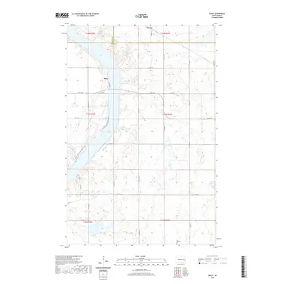
2020 Map of Sibley
USGS Topo · Published 2020About this map
Lake Ashtabula dominates the central corridor of this North Dakota landscape, where the reservoir is flanked by the communities of Sibley and Luverne. The terrain is characterized by a dense network of glacial prairie potholes and wetlands typical of the region, interspersed with a geometric grid of rural roads such as Burkhart Dr and 118th St SE. For genealogists and local historians, the southern reach of the map preserves the location of the Free Methodist Cem, providing a fixed point for family research in this part of Barnes County. Recreation is central to the area's modern character, highlighted by the path of the N Country National Scenic Trail winding along the western bluffs and specific access points like Meyers Canoe along the lakeshore.
Find a feature on this map
31 named features on this map. Tap any name to fly to it.
Don’t see what you’re looking for? This feature index may not catch every label — zoom into the map to look around manually.
Map Details
Editions of this 2020 Sibley Map
This is the sole edition of this map. No revisions or reprints were ever made.
Other maps of this area

1952 · Grand Forks
USGS Topo · 1:250,000

1952 · New Rockford
USGS Topo · 1:250,000

1956 · New Rockford
USGS Topo · 1:250,000

1956 · Grand Forks
USGS Topo · 1:250,000

1961 · Baldhill Dam
USGS Topo · 1:24,000

1961 · Dazey NE
USGS Topo · 1:24,000

1961 · Karnak
USGS Topo · 1:24,000

1966 · Grand Forks
USGS Topo · 1:250,000

1967 · Pillsbury SE
USGS Topo · 1:24,000
1967 · Pillsbury SW
USGS Topo · 1:24,000