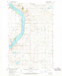
1967 Map of Sibley
USGS Topo · Published 1969About this map
Lake Ashtabula dominates this landscape along the Sheyenne River, serving as a focal point for the region during the late 1960s. The reservoir, noted here at its normal pool elevation of 1266 feet, borders the settlement of Sibley, where local amenities like a Campground and Boat Ramp indicate the area's development for recreation. To the east, the Great Northern railroad cuts through the terrain near Goose Lake, connecting these prairie lands to broader trade networks.
Find a feature on this map
19 named features on this map. Tap any name to fly to it.
Don’t see what you’re looking for? This feature index may not catch every label — zoom into the map to look around manually.
Map Details
Editions of this 1967 Sibley Map
This is the sole edition of this map. No revisions or reprints were ever made.
Other maps of this area

1952 · Grand Forks
USGS Topo · 1:250,000

1952 · New Rockford
USGS Topo · 1:250,000

1956 · New Rockford
USGS Topo · 1:250,000

1956 · Grand Forks
USGS Topo · 1:250,000

1961 · Baldhill Dam
USGS Topo · 1:24,000

1961 · Dazey NE
USGS Topo · 1:24,000

1961 · Karnak
USGS Topo · 1:24,000

1966 · Grand Forks
USGS Topo · 1:250,000

1967 · Pillsbury SE
USGS Topo · 1:24,000
1967 · Pillsbury SW
USGS Topo · 1:24,000