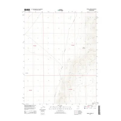
2014 Map of Sidehill Spring
USGS Topo · Published 2014About this map
Cave Valley and the western slopes of the Schell Creek Range dominate this Nevada landscape, where water sources are the primary landmarks of the high desert. Life in this portion of Lincoln County centers on isolated water points like Sidehill Spring, Jasper Spring, and Mule Shoe Spring, which have long served as vital stops for livestock and travelers. The terrain transitions from the alluvial floor of the valley, drained by the Cave Valley Wash, into the steep, rising contours of the mountains to the east. A single thoroughfare, Cave Valley Rd, provides the main north-south access through this arid corridor. The map also touches on the northern reaches of Muleshoe Valley and identifies local hydrological features such as Cris Spring, reflecting the essential nature of water rights and geographic placement in the Great Basin's range-and-basin topography.
Find a feature on this map
13 named features on this map. Tap any name to fly to it.
Don’t see what you’re looking for? This feature index may not catch every label — zoom into the map to look around manually.
Map Details
Editions of this 2014 Sidehill Spring Map
This is the sole edition of this map. No revisions or reprints were ever made.
Other maps of this area

1956 · Lund
USGS Topo · 1:250,000

1960 · Lund
USGS Topo · 1:250,000

1969 · Shingle Pass
USGS Topo · 1:24,000

1969 · Shingle Pass SE
USGS Topo · 1:24,000

1971 · Sidehill Spring
USGS Topo · 1:24,000

1971 · Cave Valley Well
USGS Topo · 1:24,000

1971 · Sidehill Pass
USGS Topo · 1:24,000
1971 · Silver King Well
USGS Topo · 1:24,000
1973 · Grassy Mtn
USGS Topo · 1:24,000
1973 · Dutch John Mtn
USGS Topo · 1:24,000