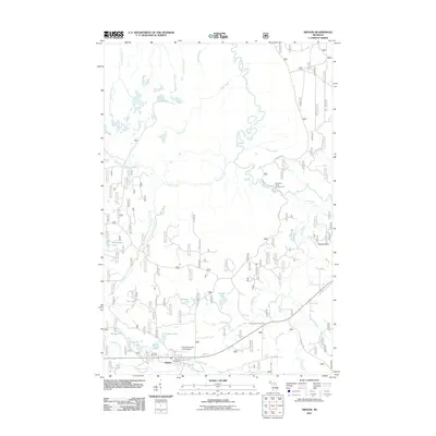
2011 Map of Sidnaw
USGS Topo · Published 2011About this map
Sidnaw serves as the primary settlement in this portion of the Upper Peninsula, located along Ontario St near the Sidnaw Post Office. This 2011 survey documents a landscape defined by an extensive network of waterways, including the winding Sturgeon River and Perch River, which support recreational sites like the Sturgeon River Campground and the Perch River Picnic Area. The area is characterized by numerous small lakes such as Moonshine Lake, High Lake, and Pequet Lake, interspersed with a complex system of forestry roads including FS RD 2217 and Forest RD 408.
Find a feature on this map
37 named features on this map. Tap any name to fly to it.
Don’t see what you’re looking for? This feature index may not catch every label — zoom into the map to look around manually.
Map Details
Editions of this 2011 Sidnaw Map
This is the sole edition of this map. No revisions or reprints were ever made.
Other maps of this area

1895 · Perch Lake
USGS Topo · 1:62,500

1954 · Rousseau
USGS Topo · 1:62,500

1954 · Kenton
USGS Topo · 1:62,500

1954 · Perch Lake
USGS Topo · 1:62,500

1954 · Sidnaw
USGS Topo · 1:62,500

1958 · Iron River
USGS Topo · 1:250,000

1960 · Iron River
USGS Topo · 1:250,000

1961 · Iron River
USGS Topo · 1:250,000

1967 · Iron River
USGS Topo · 1:250,000
1982 · Echo Lake
USGS Topo · 1:25,000