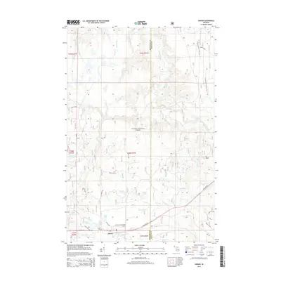
2014 Map of Sidnaw
USGS Topo · Published 2014About this map
Sidnaw anchors the southern edge of this survey where State Hwy 28 cuts through the dense timberlands of the Ottawa National Forest. The map documents a landscape defined by its intricate water network, including the Sturgeon River and the meandering Perch River, alongside numerous small water bodies such as Pequet Lake and Moonshine Lake. Local infrastructure is represented by the Prickett-Grooms Field Airport and the Sidnaw Cemetery, while the N Country National Scenic Trail winds through the northern sections, passing landmarks like Mt Kallio. This geography reveals a community built around forest access and recreational waterways, with a dense network of logging roads like Market Lake Rd and various Forest Service routes providing the primary means of navigation through the Upper Peninsula wilderness.
Find a feature on this map
44 named features on this map. Tap any name to fly to it.
Don’t see what you’re looking for? This feature index may not catch every label — zoom into the map to look around manually.
Map Details
Editions of this 2014 Sidnaw Map
This is the sole edition of this map. No revisions or reprints were ever made.
Other maps of this area

1895 · Perch Lake
USGS Topo · 1:62,500

1954 · Rousseau
USGS Topo · 1:62,500

1954 · Kenton
USGS Topo · 1:62,500

1954 · Perch Lake
USGS Topo · 1:62,500

1954 · Sidnaw
USGS Topo · 1:62,500

1958 · Iron River
USGS Topo · 1:250,000

1960 · Iron River
USGS Topo · 1:250,000

1961 · Iron River
USGS Topo · 1:250,000

1967 · Iron River
USGS Topo · 1:250,000
1982 · Echo Lake
USGS Topo · 1:25,000