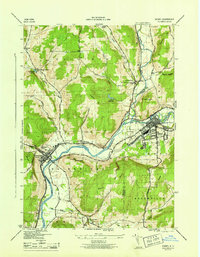
1945 Map of Sidney
USGS Topo · Published 1945About this map
The Susquehanna River and the Unadilla River converge at the heart of this mid-1940s landscape, marking the junction of Chenango, Otsego, and Delaware counties. The village of Sidney serves as a principal hub, featuring a prominent Landing Field and the intersection of the D & H and New York Ontario and Western railroads. This transportation corridor follows the river valleys, connecting smaller settlements like Bainbridge and East Guilford.
Find a feature on this map
46 named features on this map. Tap any name to fly to it.
Don’t see what you’re looking for? This feature index may not catch every label — zoom into the map to look around manually.
Map Details
Editions of this 1945 Sidney Map
This is the sole edition of this map. No revisions or reprints were ever made.
Other maps of this area

1902 · Coventry
USGS Topo · 1:62,500

1904 · Oxford
USGS Topo · 1:62,500

1905 · Nineveh
USGS Topo · 1:62,500

1915 · Unadilla
USGS Topo · 1:62,500

1918 · Unadilla
USGS Topo · 1:62,500

1924 · Deposit
USGS Topo · 1:62,500

1926 · Deposit
USGS Topo · 1:62,500

1943 · Sidney
USGS Topo · 1:24,000

1943 · Gilbertsville
USGS Topo · 1:24,000
1943 · Unadilla
USGS Topo · 1:24,000