
2014 Map of Sidney SE
USGS Topo · Published 2014About this map
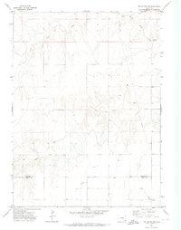
The high plains of the Nebraska-Colorado border define this landscape, where the administrative boundary separates Logan County from Cheyenne County. This region is characterized by a grid of rural section lines, including Road 125 and Road 135, which navigate the subtle drainage basins of the area. Significant water features include the Curtiselsen Reservoir and the winding course of Cow Cr in the northern portion of the map, while Cottonwood Cr meanders through the southern reaches. The presence of the Ne-17e-Link highlights the transportation infrastructure connecting this agricultural periphery to larger regional networks, providing a clear view of the land-use patterns in this borderland during the early 21st century.
Find a feature on this map
21 named features on this map. Tap any name to fly to it.
Don’t see what you’re looking for? This feature index may not catch every label — zoom into the map to look around manually.
Map Details
Editions of this 2014 Sidney SE Map
This is the sole edition of this map. No revisions or reprints were ever made.
Other maps of this area

1899 · Sidney
USGS Topo · 1:125,000

1953 · Twin Buttes
USGS Topo · 1:24,000

1953 · Haystack Butte
USGS Topo · 1:24,000

1953 · Julesburg Reservoir
USGS Topo · 1:24,000

1954 · Sterling
USGS Topo · 1:250,000

1954 · Scottsbluff
USGS Topo · 1:250,000

1958 · Scottsbluff
USGS Topo · 1:250,000

1958 · Sterling
USGS Topo · 1:250,000
1971 · Twin Buttes
USGS Topo · 1:24,000

1972 · Lodgepole
USGS Topo · 1:24,000