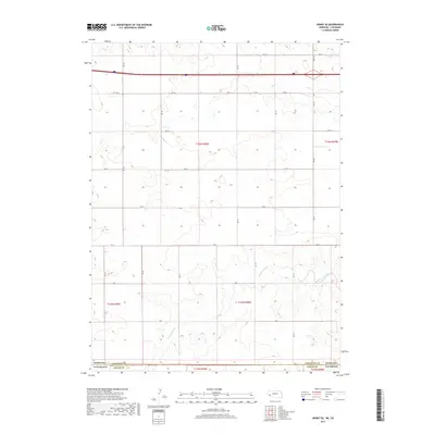
2017 Map of Sidney SE
USGS Topo · Published 2017About this map
The Nebraska-Colorado state line cuts through this high plains landscape, marking the intersection of Cheyenne County, Nebraska, and Logan County, Colorado. The terrain is defined by the intermittent drainage patterns of the region, specifically Cow Cr in the northern section and Cottonwood Creek flowing through the southeast. This geography reflects the agricultural and ranching transitions along the 41st parallel, where the land is partitioned into a strict grid of county roads including Rd 18, Rd 14, and Rd 8. These roads provide the primary structure for movement across the expansive range, connecting various sections of Township 12 and 13 North. The map illustrates a sparsely populated borderland where water sources like Cottonwood Cr dictate the layout of the rural landscape.
Find a feature on this map
17 named features on this map. Tap any name to fly to it.
Don’t see what you’re looking for? This feature index may not catch every label — zoom into the map to look around manually.
Map Details
Editions of this 2017 Sidney SE Map
This is the sole edition of this map. No revisions or reprints were ever made.
Other maps of this area

1899 · Sidney
USGS Topo · 1:125,000

1953 · Twin Buttes
USGS Topo · 1:24,000

1953 · Haystack Butte
USGS Topo · 1:24,000

1953 · Julesburg Reservoir
USGS Topo · 1:24,000

1954 · Sterling
USGS Topo · 1:250,000

1954 · Scottsbluff
USGS Topo · 1:250,000

1958 · Scottsbluff
USGS Topo · 1:250,000

1958 · Sterling
USGS Topo · 1:250,000
1971 · Twin Buttes
USGS Topo · 1:24,000

1972 · Lodgepole
USGS Topo · 1:24,000