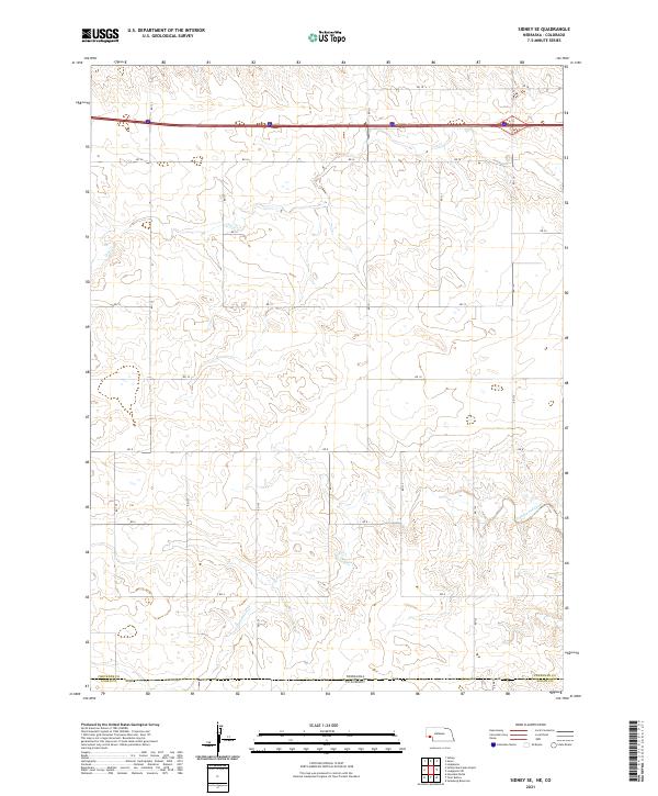
2021 Map of Sidney SE
USGS Topo · Published 2021About this map
The Nebraska and Colorado state line bisects this high plains landscape, where the southern reaches of Cheyenne and Logan counties meet. The terrain is defined by a grid of rural section roads, including RD 18 and RD 16, which cross the rolling drainage basins of the region. Waterways are the primary landmarks in this expanse, most notably the seasonal flow of Cow Creek in the north and the winding path of Cottonwood Creek in the south. This survey captures the intersection of large-scale township boundaries, including t13n r48w and t12n r48w, reflecting the enduring structure of the Public Land Survey System in the American West. The geography here is a study in borderland topography, illustrating how drainage patterns like Cottonwood Creek ignore administrative boundaries.
Find a feature on this map
17 named features on this map. Tap any name to fly to it.
Don’t see what you’re looking for? This feature index may not catch every label — zoom into the map to look around manually.
Map Details
Editions of this 2021 Sidney SE Map
This is the sole edition of this map. No revisions or reprints were ever made.
Other maps of this area

1899 · Sidney
USGS Topo · 1:125,000

1953 · Twin Buttes
USGS Topo · 1:24,000

1953 · Haystack Butte
USGS Topo · 1:24,000

1953 · Julesburg Reservoir
USGS Topo · 1:24,000

1954 · Sterling
USGS Topo · 1:250,000

1954 · Scottsbluff
USGS Topo · 1:250,000

1958 · Scottsbluff
USGS Topo · 1:250,000

1958 · Sterling
USGS Topo · 1:250,000
1971 · Twin Buttes
USGS Topo · 1:24,000

1972 · Lodgepole
USGS Topo · 1:24,000