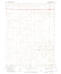
1972 Map of Sidney SE
USGS Topo · Published 1976About this map
The high plains of the Nebraska Colorado border come into sharp focus in the early 1970s, where the rural landscape is defined by the intermittent drainage of Cow Creek and Cottonwood Creek. This survey captures the region during the expansion of the modern interstate era, as Interstate 80 cuts across the northern edge of the map, contrasting with the legacy of local education represented by School No 97. The terrain is marked by essential infrastructure and industry for the period, including several Gravel Pits and a prominent Radio Tower. The map provides a precise record of the administrative boundary where Cheyenne County, Nebraska and Logan County, Colorado meet, illustrating a sparsely populated ranching or agricultural environment at the height of the 20th century.
Find a feature on this map
9 named features on this map. Tap any name to fly to it.
Don’t see what you’re looking for? This feature index may not catch every label — zoom into the map to look around manually.
Map Details
Editions of this 1972 Sidney SE Map
This is the sole edition of this map. No revisions or reprints were ever made.
Other maps of this area

1899 · Sidney
USGS Topo · 1:125,000

1953 · Twin Buttes
USGS Topo · 1:24,000

1953 · Haystack Butte
USGS Topo · 1:24,000

1953 · Julesburg Reservoir
USGS Topo · 1:24,000

1954 · Sterling
USGS Topo · 1:250,000

1954 · Scottsbluff
USGS Topo · 1:250,000

1958 · Scottsbluff
USGS Topo · 1:250,000

1958 · Sterling
USGS Topo · 1:250,000
1971 · Twin Buttes
USGS Topo · 1:24,000

1972 · Lodgepole
USGS Topo · 1:24,000