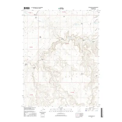
2017 Map of Sids Mountain
USGS Topo · Published 2017About this map
The San Rafael River carves a deep, winding course through the heart of this landscape, creating the dramatic geological features known as the The Wedge and the Little Grand Canyon. This 2017 survey details the complex topography of the San Rafael Swell, where high elevations like Sids Mountain and No Mans Mtn overlook a network of drainage systems including Virgin Spring Canyon and Saddle Horse Canyon.
Find a feature on this map
26 named features on this map. Tap any name to fly to it.
Don’t see what you’re looking for? This feature index may not catch every label — zoom into the map to look around manually.
Map Details
Editions of this 2017 Sids Mountain Map
This is the sole edition of this map. No revisions or reprints were ever made.
Other maps of this area

1885 · San Rafael
USGS Topo · 1:250,000

1886 · Price River
USGS Topo · 1:250,000

1896 · Price River
USGS Topo · 1:250,000

1952 · San Rafael Knob
USGS Topo · 1:62,500

1953 · Wilsonville SE
USGS Topo · 1:24,000

1953 · Red Plateau SW
USGS Topo · 1:24,000

1954 · Stinking Spring Creek 1 NW
USGS Topo · 1:24,000

1954 · Stinking Spring Creek 2 NE
USGS Topo · 1:24,000
1954 · Wilsonville SE
USGS Topo · 1:24,000
1954 · Stinking Spring Creek 2 NW
USGS Topo · 1:24,000