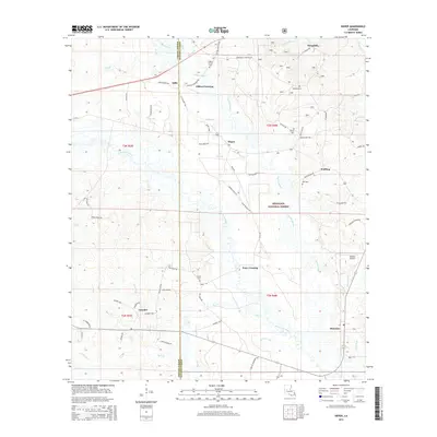
2015 Map of Sieper
USGS Topo · Published 2015About this map
The Calcasieu River and its numerous tributaries, including Cypress Bayou and Merchant Br, define the landscape of this central Louisiana region within the Kisatchie National Forest. Small, scattered settlements such as Sieper, Stille, and Clifton Crossing are connected by a network of rural roads, many of which carry the names of local families like Harald Ivey Rd, Gary Price Rd, and John Wallace Rd. This pattern of naming reflects a deep-rooted genealogical history in the area, further evidenced by the multiple small burial grounds such as Hardshell Cem, Burns Cem, and Smith Cem. Cultural landmarks like Pisgah Church and the Roland Airport near Hineston highlight the intersection of traditional community life and modern regional infrastructure in this forested terrain.
Find a feature on this map
65 named features on this map. Tap any name to fly to it.
Don’t see what you’re looking for? This feature index may not catch every label — zoom into the map to look around manually.
Map Details
Editions of this 2015 Sieper Map
This is the sole edition of this map. No revisions or reprints were ever made.
Other maps of this area

1932 · Boyce SW
USGS Topo · 1:31,680

1937 · Chopin SW
USGS Topo · 1:31,680

1937 · Chopin SE
USGS Topo · 1:31,680

1941 · Boyce
USGS Topo · 1:62,500

1943 · Leander
USGS Topo · 1:62,500

1944 · Chopin
USGS Topo · 1:62,500

1948 · Chopin
USGS Topo · 1:62,500

1953 · Alexandria
USGS Topo · 1:250,000
1954 · Leander
USGS Topo · 1:62,500
1954 · Temple
USGS Topo · 1:24,000